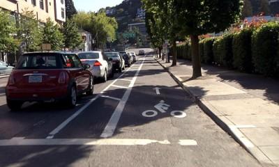
As you all know, May 1 marks the start of Bike Month. But some of you might not know that it also marks the start of the City of Seattle’s public outreach process around the update of the Seattle Bicycle Master Plan (BMP). Originally scheduled to be updated after five years, the 2007 BMP has led the Seattle Department of Transportation (SDOT) to build 129 miles of bike lanes and sharrows, 98 miles of signed routes, and 2,230 bike parking spaces.
This year’s overhaul presents us with the opportunity to get innovative new tools and best practices into the updated plan – things like cycle tracks, neighborhood greenways, and buffered bike lanes. Getting these treatments in the plan – and ultimately on the ground – will help people of all ages and abilities make safe and efficient trips by bike to key destinations like transit stations, schools, parks, grocery stores, downtown, and neighborhood centers.

A low-cost cycle track in Portland, OR. Source: http://www.portlandonline.com
As part of their public outreach efforts, SDOT is launching two brand new tools as of May 1 to help you tell SDOT how you currently use existing bicycle facilities, as well as what you would like to see in the future.
Tell them! The first tool is a short web-based survey to comment on the bicycle issues that matter most to you. It should only take about 10 minutes and is one of the simplest ways to comment on how you feel about biking in Seattle and what you want to see out of the BMP update.
Show them! The second tool is an brand new and exciting interactive map that allows you to show SDOT more specifically where you make (or would like to make) bike trips, which streets and intersections are particularly challenging, as well as what works really well for you.
Both of these show and tell tools can be accessed here.
***
Speaking of fun and exciting and bike mapping applications, also starting today, the Puget Sound Regional Council (PSRC) is encouraging bicyclists with smartphone capabilities to record all their bicycle trips using an innovative smartphone application called CycleTracks.
The data collected through this application will provide insight into the routes that bicycle riders currently use based on level of experience and characteristics of their route. Ultimately, this information will help PSRC and other jurisdictions like Seattle to better understand bicycle trip-making behavior across the region and inform their transportation planning efforts.
***
Finally, while you are out there, don’t forget to enjoy yourself. After all, riding a bike is one of life's simple pleasures.
Share this post
